July 17
travel day.
Zero miles
Our ride in the morning is from a man named Randy who lives in Mt. Shasta. Randy is in his late 70s and is an avid hiker. He says he usually hikes about 1,500 miles per year, but is unable to carry a pack this year because of a recovery from shoulder surgery. His wife is used to having him out of the house more. “My wife is mad about me being in the house all the time. She doesnt like the look of me,” Randy quips.
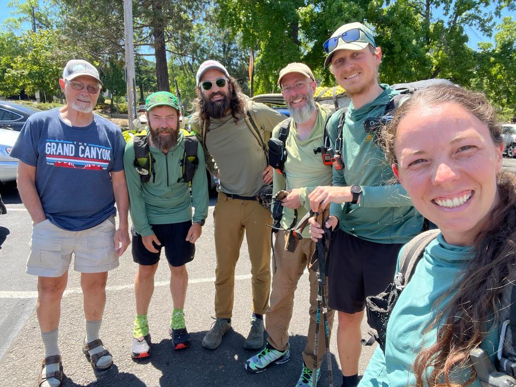
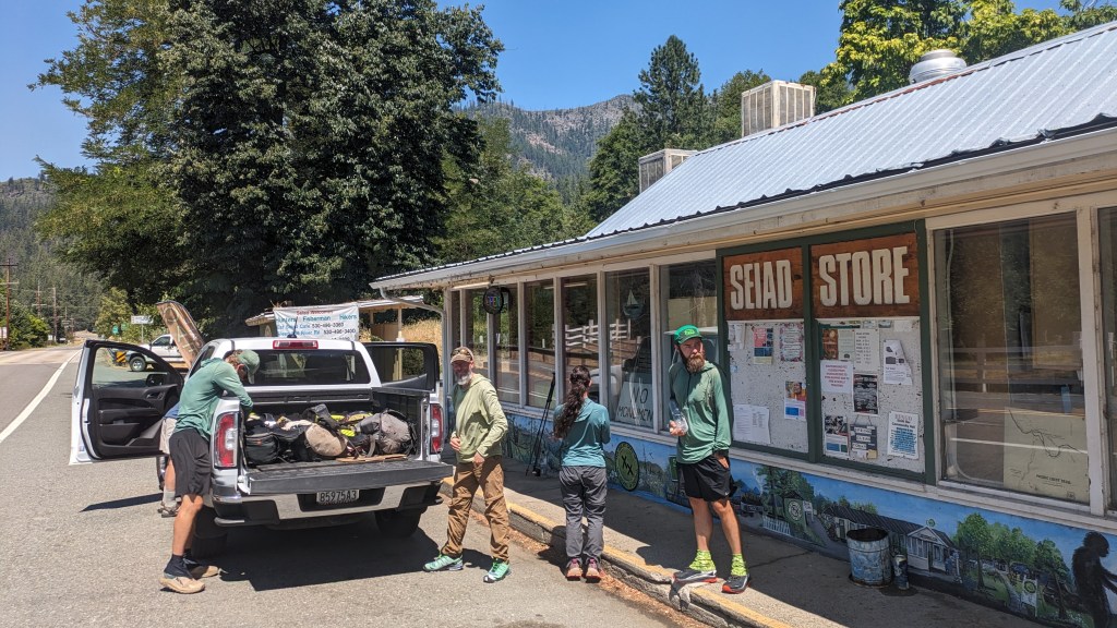
He is giving back to hikers during his convalescence. He drives us around the fire closure to the tiny Hamlet of Seiad Valley, CA right in the heart of the State of Jefferson. The state of Jefferson is an area spanning south eastern Oregon and California that has unsuccessfully tried to secede from the union multiple times.
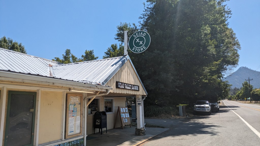
There is one building in town, the cafe/general store/post office. The building is emblazoned with an X X, representing the idea that this area has been double crossed by state and federal governments.

We invite Randy to eat breakfast with us. The owner of the cafe is also the greeter and seater, waitress, chef, busser, and dishwasher. She is a one woman show and works for as many hours as she can keep up with it, usually 7am-2pm. In the 90 minutes we are in the restaurant a single car passes by.
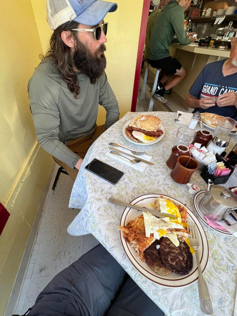
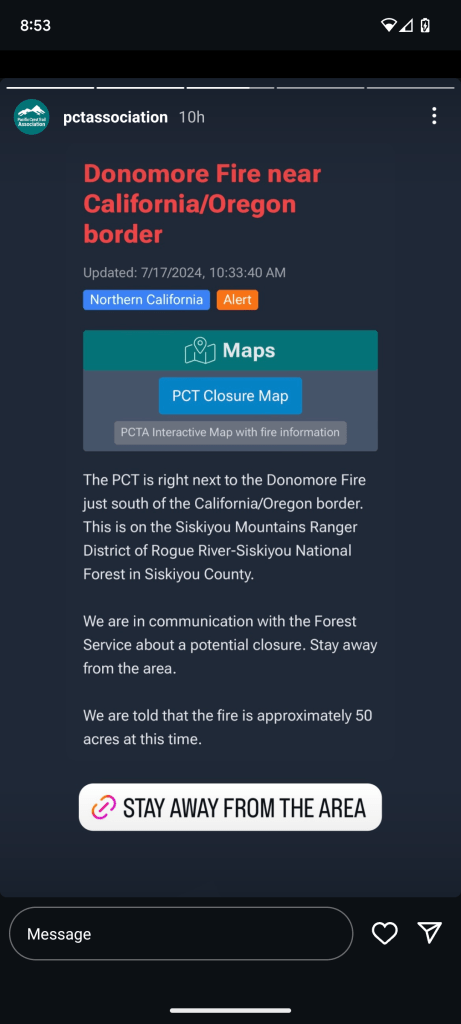
As we eat we learn of a new fire that sparked just a few miles north of us on the Oregon/California border. It grew from 0.1 acres to 45 acres in just a few hours. We discuss the fire with two other hikers in the cafe, Sin Nombre and One town, as well as a Seiad Valley local. He tells us he has lost 14 friends to fires over the last 3 years. The danger of wildfires is nothing new to this community. Seiad Valley exists in a narrow, densely forested canyon with single entrance and exit points. Many houses are up along remote, winding, dirt roads. The state of Jefferson attracts folks who want some privacy.
Look at this map showing fires on the 16th and then on the 17th.
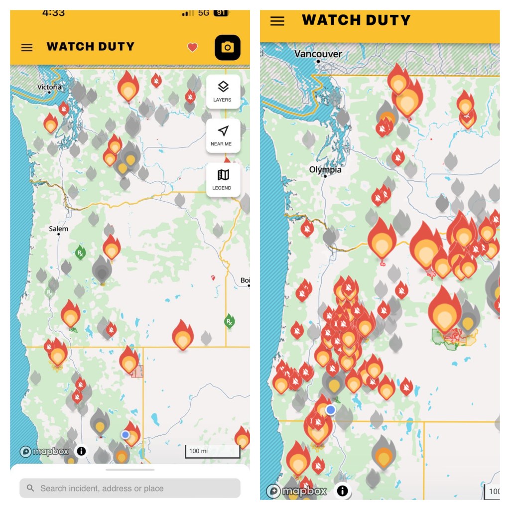
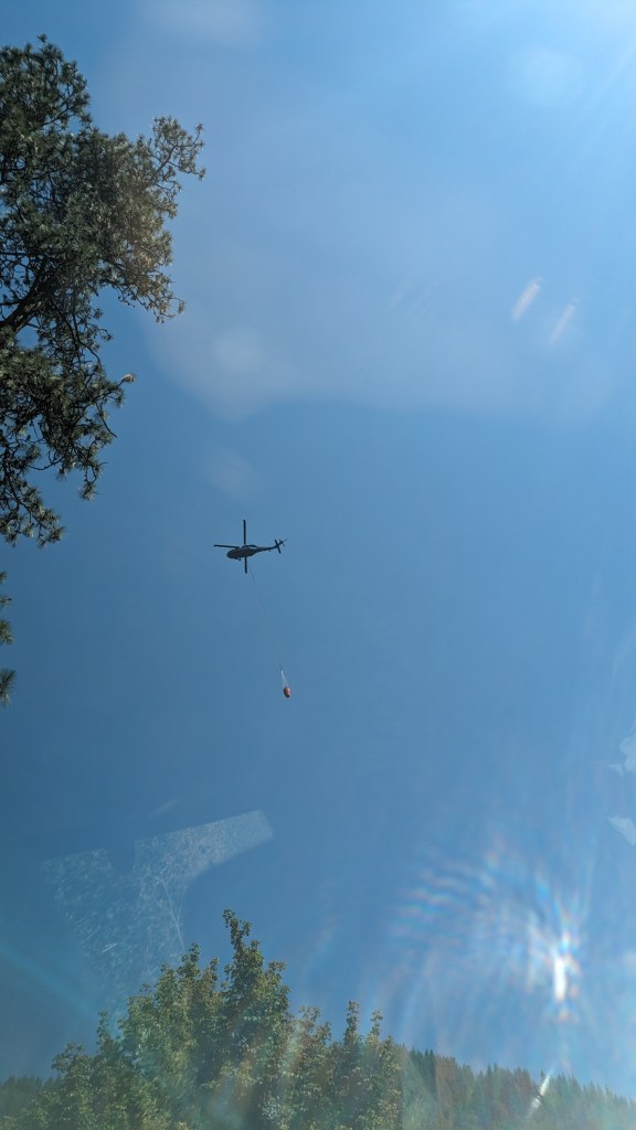
Overnight there were 1000 lightning strikes from a dry lightning storm that hit northern CA, OR, and WA. Weeks of no rain and an extended heatwave has turned the entire northwest into a tinderbox. We learn of two hikers just ahead of us who were 0.7 miles from the Oregon border before being turned back by the fire and bailing down a road. Overhead a helicopter carrying a massive bucket of water heads towards the newly sparked fire.
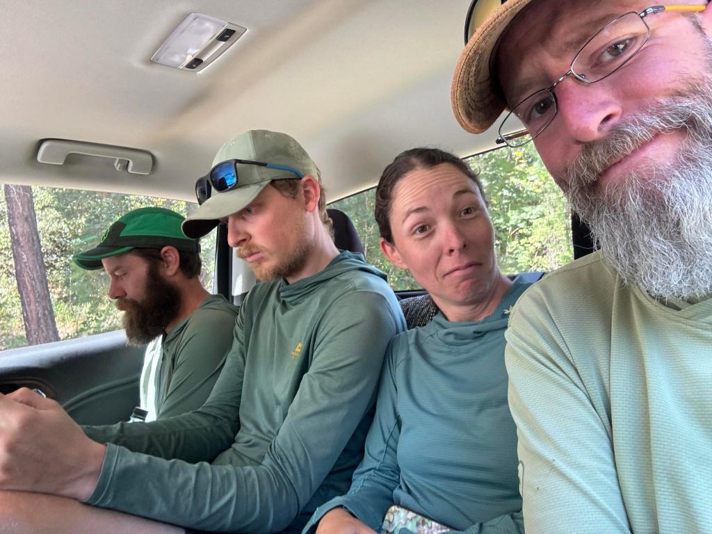
The PCTA recommends hikers avoid the area, and so we must also skip this section. Randy offers to squeeze all 5 of us and drive us to the next town along the trail, Ashland Oregon.
After hiking over 1500 miles through California, we pass into Oregon via car. This is massively disappointing to us as this border crossing is an enormous milestone on this journey.
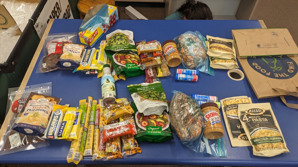
The PCT through Oregon passes close to very few towns. Instead, it travels next to small fishing lodges that allow hikers to mail food to them for pickup. We spend the rest of the day purchasing, organizing, and mailing out food for some critical portions of Oregon.

Leave a reply to Lidia Cancel reply